
DIG DEEP INTO YOUR SOIL: UPCOMING FIELD DAY 🌿
Curious about the geology of the Ellesmere area and how it affects water and nutrient movement on your farm?
Join Clint Rissman from Land & Water Science for an informative Field Day on Radiometric Soil Mapping—a cutting-edge tool that provides detailed, accurate soil maps to help farmers make smarter decisions about:
✅ Irrigation efficiency
✅ Fertiliser use
✅ Nutrient management
✅ Freshwater contamination risks
✅ Future consent applications
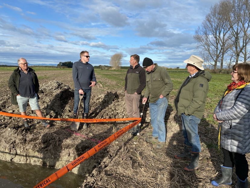
This hands-on, informal day gives you a chance to see real data in action as Clint ground truths soil maps at several farm sites. Ask questions, explore the science, and discover what it could mean for your farm’s future.
📅 Date: Friday, 14th March
⏰ Time: 10 AM – 1 PM
📍 Meet at: Leeston-Exact location provided upon registration
🥪 Wrap up with an informal lunch at the last stop!
Don’t miss this chance to better understand your land and how small changes could make a big impact.
To register contact jo.tinaku@esai.co.nz 0210 304 783

